

180: Rare Books
ATLAS - LE PETIT ATLAS BRITANNIQUE, Ou recueil des Province d'Angleterre et de la Principaute de Galles, avec une Carte Generale ....
.jpg?width=720&height=720&resizeinbox=true)
150
ATLAS - LE PETIT ATLAS BRITANNIQUE, Ou recueil des Province d'Angleterre et de la Principaute de Galles, avec une Carte Generale ....
Reserve not met
Est.
$800 - $1,200
Sold
$550
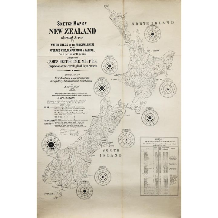
BAIN, BRYCE, Sketch Map of New Zealand Showing Areas of Water Sheds
151
BAIN, BRYCE, Sketch Map of New Zealand Showing Areas of Water Sheds
Est.
$300 - $500
Sold
$350
CARY, JOHN, New Map of England and Wales with part of Scotland
.jpg?width=720&height=720&resizeinbox=true)
152
CARY, JOHN, New Map of England and Wales with part of Scotland
Starting Bid: $400
Reserve not met
Est.
$600 - $800
Ended
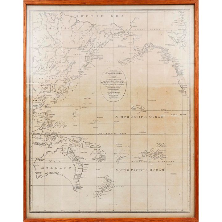
CHART OF NORTH & SOUTH PACIFIC, A New and Accurate Chart of the Discoveries of Capt. Cook, and other later Circumnavigators,
153
CHART OF NORTH & SOUTH PACIFIC, A New and Accurate Chart of the Discoveries of Capt. Cook, and other later Circumnavigators,
Est.
$200 - $400
Sold
$450
DAVID, ANDREW [chief editor], The Charts & Coastal Views of Captain Cook's Voyages. Volume One.
![DAVID, ANDREW [chief editor], The Charts & Coastal Views of Captain Cook's Voyages. Volume One.](https://images4-cdn.auctionmobility.com/is3/auctionmobility-static4/1TQL-4-17QZ8N/4-7YKHD9/180-154.jpg?width=720&height=720&resizeinbox=true)
154
DAVID, ANDREW [chief editor], The Charts & Coastal Views of Captain Cook's Voyages. Volume One.
Est.
$200 - $400
Sold
$450
GREEN'S MOTOR & CYCLING ROAD MAP, of New Zealand, South Island
.jpg?width=720&height=720&resizeinbox=true)
155
GREEN'S MOTOR & CYCLING ROAD MAP, of New Zealand, South Island
Est.
$150 - $250
Sold
$300
KOCH AUGUSTUS [1834-1901], Map of the Colony of New Zealand
![KOCH AUGUSTUS [1834-1901], Map of the Colony of New Zealand](https://images4-cdn.auctionmobility.com/is3/auctionmobility-static4/SGaA-4-17QZ8N/4-7YKHDD/180-156-(1).jpg?width=720&height=720&resizeinbox=true)
156
KOCH AUGUSTUS [1834-1901], Map of the Colony of New Zealand
Est.
$600 - $800
Sold
$850
LAURIE, R.H., Laurie's Map of New Zealand
.jpg?width=720&height=720&resizeinbox=true)
157
LAURIE, R.H., Laurie's Map of New Zealand
Est.
$1,000 - $1,800
Sold
$1,200
LE ROUGE, GEORGES LOUIS, Atlas Nouveau Portatif [New portable atlas for the use of soldiers, colleges and travellers...]
![LE ROUGE, GEORGES LOUIS, Atlas Nouveau Portatif [New portable atlas for the use of soldiers, colleges and travellers...]](https://images4-cdn.auctionmobility.com/is3/auctionmobility-static4/Q7Qd-4-17QZ8N/4-7YKHDH/180-158-(1).jpg?width=720&height=720&resizeinbox=true)
158
LE ROUGE, GEORGES LOUIS, Atlas Nouveau Portatif [New portable atlas for the use of soldiers, colleges and travellers...]
Est.
$200 - $400
Sold
$500
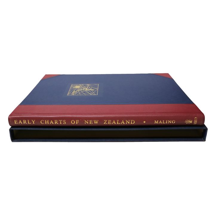
MALING, PETER B., Early Charts of New Zealand 1542 - 1851
159
MALING, PETER B., Early Charts of New Zealand 1542 - 1851
Est.
$200 - $300
Sold
$140
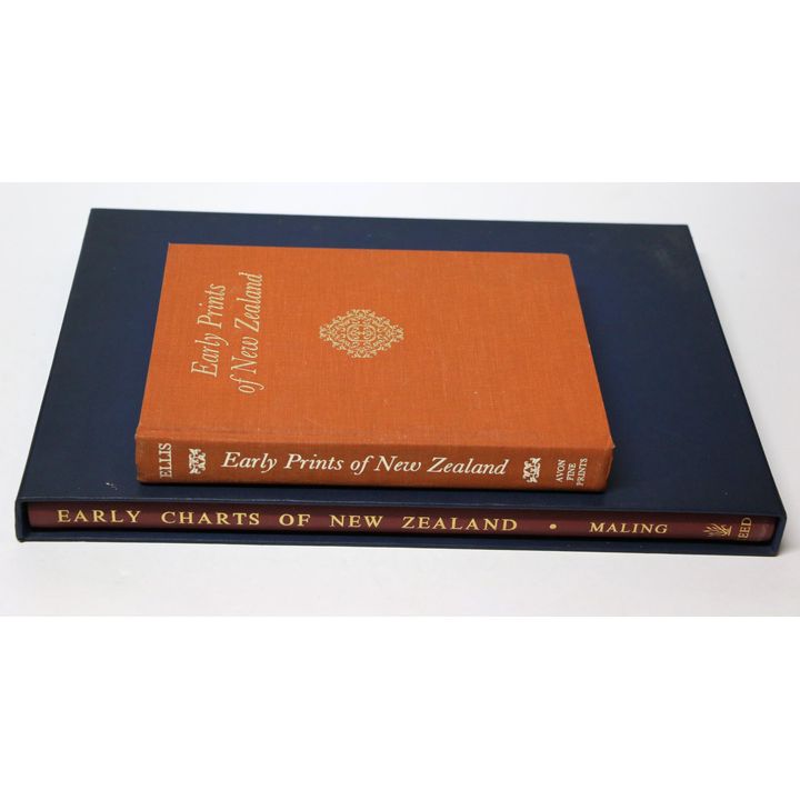
MALING, PETER B., Early Charts of New Zealand 1542 - 1851
160
MALING, PETER B., Early Charts of New Zealand 1542 - 1851
Est.
$250 - $400
Sold
$250
MALING, PETER B., Historic Charts & Maps of New Zealand 1642-1875
.jpg?width=720&height=720&resizeinbox=true)
161
MALING, PETER B., Historic Charts & Maps of New Zealand 1642-1875
Est.
$300 - $400
Sold
$400
MAP - PROVINCE OF CANTERBURY NEW ZEALAND, WEST SIDE
.jpg?width=720&height=720&resizeinbox=true)
162
MAP - PROVINCE OF CANTERBURY NEW ZEALAND, WEST SIDE
Est.
$400 - $600
Sold
$300
MAP - PROVINCIAL GOVERNMENT - Province of Canterbury
.jpg?width=720&height=720&resizeinbox=true)
163
MAP - PROVINCIAL GOVERNMENT - Province of Canterbury
Est.
$200 - $400
Sold
$250
MAPS - OTAHU & WAIAU AREAS, SOUTHLAND [3X]
![MAPS - OTAHU & WAIAU AREAS, SOUTHLAND [3X]](https://images4-cdn.auctionmobility.com/is3/auctionmobility-static4/SmSe-4-17QZ8N/4-7YKHDT/180-164-(1).jpg?width=720&height=720&resizeinbox=true)
164
MAPS - OTAHU & WAIAU AREAS, SOUTHLAND [3X]
Est.
$400 - $600
Sold
$250
NEW ZEALAND GEOGRAPHICAL SOCIETY - Maps of Canterbury & the West Coast. A Selected Bibliography.
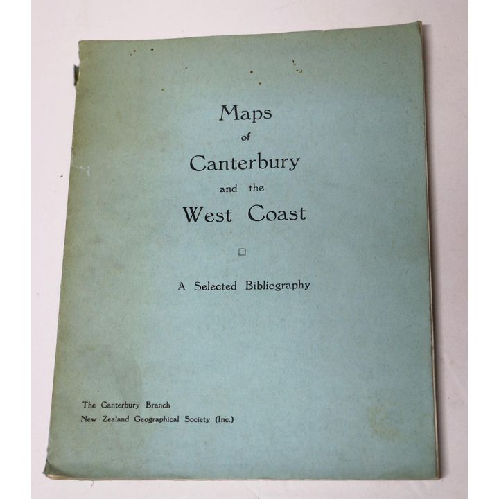
165
NEW ZEALAND GEOGRAPHICAL SOCIETY - Maps of Canterbury & the West Coast. A Selected Bibliography.
Starting Bid: $30
Est.
$50 - $100
Ended
PALIN, T.W., Sketch Map of the North Island of New Zealand

166
PALIN, T.W., Sketch Map of the North Island of New Zealand
Est.
$400 - $600
Sold
$350
POLLEN, C.R, Provincial District of Auckland. Sheet No.3
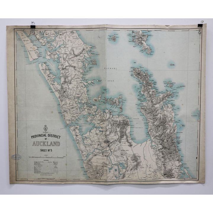
167
POLLEN, C.R, Provincial District of Auckland. Sheet No.3
Est.
$200 - $400
Sold
$200
SAUNDERS, TRELAWNEY. WILLIAM [1821-1910], Part of the Canterbury Settlement.
![SAUNDERS, TRELAWNEY. WILLIAM [1821-1910], Part of the Canterbury Settlement.](https://images4-cdn.auctionmobility.com/is3/auctionmobility-static4/PX1p-4-17QZ8N/4-7YKHE1/180-168-(1).jpg?width=720&height=720&resizeinbox=true)
168
SAUNDERS, TRELAWNEY. WILLIAM [1821-1910], Part of the Canterbury Settlement.
Est.
$2,500 - $3,500
Sold
$3,500
SENEX, JOHN, Untitled Atlas [circa 1730's]
![SENEX, JOHN, Untitled Atlas [circa 1730's]](https://images4-cdn.auctionmobility.com/is3/auctionmobility-static4/iwt9-4-17QZ8N/4-7YKHE3/180-169-(1).jpg?width=720&height=720&resizeinbox=true)
169
SENEX, JOHN, Untitled Atlas [circa 1730's]
Starting Bid: $15,000
Reserve not met
Est.
$25,000 - $30,000
Ended
SPENCE, JOHN, MAP OF SOUTHLAND NEW ZEALAND
.jpg?width=720&height=720&resizeinbox=true)
170
SPENCE, JOHN, MAP OF SOUTHLAND NEW ZEALAND
Est.
$100 - $200
Sold
$250
STANFORD, EDWARD, Map of the Province of Canterbury, New Zealand,
.jpg?width=720&height=720&resizeinbox=true)
171
STANFORD, EDWARD, Map of the Province of Canterbury, New Zealand,
Est.
$600 - $1,000
Sold
$550
THOMSON, JOHN TURNBULL [Chief Surveyor], Map of the Gold Fields of Otago
![THOMSON, JOHN TURNBULL [Chief Surveyor], Map of the Gold Fields of Otago](https://images4-cdn.auctionmobility.com/is3/auctionmobility-static4/XP2F-4-17QZ8N/4-7YKHE9/180-172.jpg?width=720&height=720&resizeinbox=true)
172
THOMSON, JOHN TURNBULL [Chief Surveyor], Map of the Gold Fields of Otago
Est.
$400 - $600
Sold
$1,000
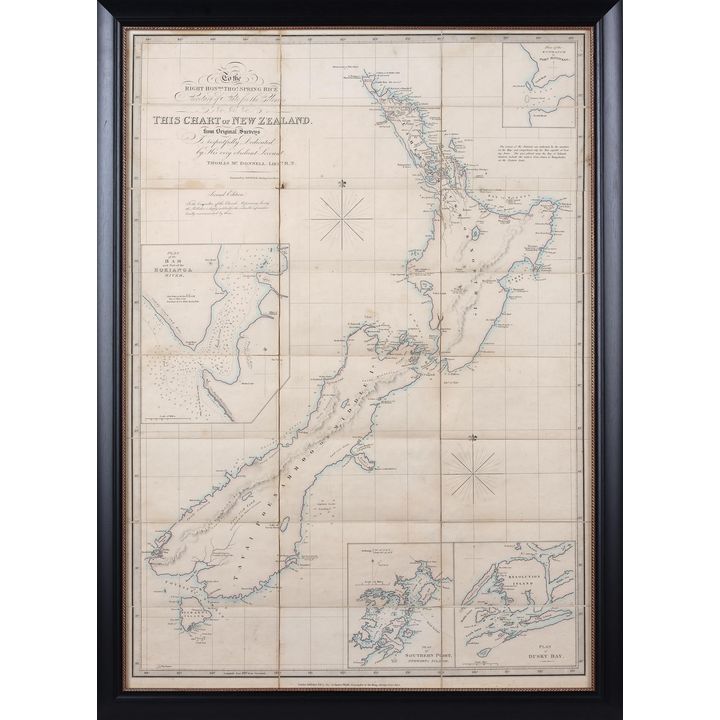
WYLD, JAMES, This Chart of New Zealand
.jpg?width=720&height=720&resizeinbox=true)
173
WYLD, JAMES, This Chart of New Zealand
Est.
$1,200 - $1,800
Sold
$1,750
WYLD, JAMES / McDONNELL THOMAS, Chart of New Zealand
174
WYLD, JAMES / McDONNELL THOMAS, Chart of New Zealand
Est.
$3,000 - $4,000
Sold
$3,000
WYLD, JAMES, The Islands of New Zealand
.jpg?width=720&height=720&resizeinbox=true)
175
WYLD, JAMES, The Islands of New Zealand
Est.
$2,000 - $3,000
Sold
$2,800
186 Rare Books, Militaria, Maps, Historical Art
BAKER, JOHN H. [Chief Surveyor Christchurch] - Canterbury Land Dist. No 27. Canterbury Runs for Sale by Auction.
![BAKER, JOHN H. [Chief Surveyor Christchurch] - Canterbury Land Dist. No 27. Canterbury Runs for Sale by Auction.](https://images4-cdn.auctionmobility.com/is3/auctionmobility-static4/8MR7-4-17QZ8N/4-A99KMW/186-342.jpg?width=720&height=720&resizeinbox=true)
342
BAKER, JOHN H. [Chief Surveyor Christchurch] - Canterbury Land Dist. No 27. Canterbury Runs for Sale by Auction.
Est.
$300 - $400
Sold
$200
BALDWYN, GEORGE AUGUSTUS - A New and Accurate Map of the World
.jpg?width=720&height=720&resizeinbox=true)
343
BALDWYN, GEORGE AUGUSTUS - A New and Accurate Map of the World
Est.
$200 - $400
Sold
$400
BETT’S FAMILY ATLAS - NEW ZEALAND - Map of New Zealand
.jpg?width=720&height=720&resizeinbox=true)
344
BETT’S FAMILY ATLAS - NEW ZEALAND - Map of New Zealand
Est.
$100 - $200
Sold
$70
CALTEX GUIDE [2 maps] - The Caltex Guide to Rotorua and District
![CALTEX GUIDE [2 maps] - The Caltex Guide to Rotorua and District](https://images4-cdn.auctionmobility.com/is3/auctionmobility-static4/1K13-4-17QZ8N/4-A99KN2/186-345-(1).jpg?width=720&height=720&resizeinbox=true)
345
CALTEX GUIDE [2 maps] - The Caltex Guide to Rotorua and District
Est.
$80 - $100
Sold
$130
COOK, CAPT JAMES - Chart of New Zealand, explored in 1769 and 1770.
.jpg?width=720&height=720&resizeinbox=true)
346
COOK, CAPT JAMES - Chart of New Zealand, explored in 1769 and 1770.
Reserve not met
Est.
$3,000 - $4,000
Sold
$2,400
COOK, CAPTAIN JAMES; SKELTON R.A. [editor] - Charts and Views
![COOK, CAPTAIN JAMES; SKELTON R.A. [editor] - Charts and Views](https://images4-cdn.auctionmobility.com/is3/auctionmobility-static4/ElMY-4-17QZ8N/4-A99KN6/186-347.jpg?width=720&height=720&resizeinbox=true)
347
COOK, CAPTAIN JAMES; SKELTON R.A. [editor] - Charts and Views
Est.
$100 - $200
Sold
$75
COOK, JAMES [3 charts] - Chart of Cook’s Strait in New Zealand
![COOK, JAMES [3 charts] - Chart of Cook’s Strait in New Zealand](https://images4-cdn.auctionmobility.com/is3/auctionmobility-static4/AHr2-4-17QZ8N/4-A99KN8/186-348-(1).jpg?width=720&height=720&resizeinbox=true)
348
COOK, JAMES [3 charts] - Chart of Cook’s Strait in New Zealand
Est.
$300 - $500
Sold
$375

GOUJON, ANDRIVEAU [2 maps] - Carte de L’Oceanie d’apres les Paris 1850
![GOUJON, ANDRIVEAU [2 maps] - Carte de L’Oceanie d’apres les Paris 1850](https://images4-cdn.auctionmobility.com/is3/auctionmobility-static4/qGek-4-17QZ8N/4-A99KNC/186-350-(1).jpg?width=720&height=720&resizeinbox=true)
350
GOUJON, ANDRIVEAU [2 maps] - Carte de L’Oceanie d’apres les Paris 1850
Starting Bid: $100
Est.
$150 - $250
Ended
GREAT BRITAIN, HYDROGRAPHIC OFFICE - MAP - Pacific Ocean, New Zealand from surveys in H.M.S. Acheron & Pandora
.jpg?width=720&height=720&resizeinbox=true)
351
GREAT BRITAIN, HYDROGRAPHIC OFFICE - MAP - Pacific Ocean, New Zealand from surveys in H.M.S. Acheron & Pandora
Est.
$1,000 - $1,500
Sold
$900

